A tricky proposal for 68E

Still cant find this sat ..intelsat 7/10 @68E..
been trying all morning ..
Have been back up the ladder to measure the seperation on the 2 lnbs ..
approx 8cm centre to center on the lnb feeds ..
9 cm on the ally bar ..
I believe the measure ments equate to approx 1.2 cm per degree ..can anyone verify this ?
6.5 x 1.2 = 7.8 cm ....which approximates nicely to roughly the seperation achieved by the above method of monitoring sig strength..

I also know that Nelson ...has picked up transponders from this bird using an 80cm dish ...and he is less than 50 miles from me ..
The difference is that he used a focal point fixed lnb ..not an offset..

I am close to concluding that Dishpointer has it a bit wrong ..and I don't have line of sight ..
Or ....that I simply can't get enough signal using an offset lnb ..and taking into account the quality and length of cable run..
This last thing I can remove from the equation ...but it means physically taking the receiver round to my dads ..and setting it up in his backyard with a short cable run to the motor..
I'm toying with the idea ..unless someone points out where I might have gone wrong ..
rgds
VS
 
hi -
i,v found dishpointer to be accurate for the direction --
elevation wise you are starting from a quite high point -- so even though the sat elevation is extremely low - there is nothing very close to you to block you and the cityscape is quite flat for a long way where you are --
i cant give you a today transponder reading as i took my 68.5 dish down and i,v used the mounting pole for a bird table camera now -----
weather conditions affected reception very stongly form this sat because of its low elevation i suppose , not just rain but low cloud -- and heat haze rather like it is here today -- would also cause the signal to come and go -- ( it could disapear for a full min sometimes then return for a while) -- and that was with a centre l.n.b. ---
maybe the position of you offset l,n,b needs tweaking the setting for 36 and 42
will probably not still apply -- when at a much steeper tilt --

good luck -- back to work for me now

regards nelson.b.
 
Vipersan said:
Or ....that I simply can't get enough signal using an offset lnb ..and taking into account the quality and length of cable run..
VS

give the weakness of signals from here sometimes especialy in odd weather
that could well be so ---

cheers --
 
Cheers Nelson ..
In a last ditch attempt to pick this bird up ..
I've taken the F15 (highest gain receiver I have ) round to my das gaff ..
Istalled with a 5 mtr cable run directly to the motor _not_ the offset lnb so I have control...
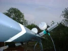
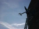
I'm also gonna take a couple of photos stood on the ladder at the side of the dish to give some idea of the terrain ..
Will report back later..
rgds
VS
 
hi - again -
just looked up my original post of my first install on this sat -- it was a limited motorised setup -- i,d forgotton that -
i later moved it to a more sheltered place but much further away -- 65 metres
and then later still removed the motor and just used the dish - fixed --
its only about a month ago that i finaly took the fixed dish down and the Mana sat t.p. was still active then --

here,s the link --- http://www.satellites.co.uk/forums/...ellite-installations/148331-53-68-5-east.html

cheers nelson.b.
 
The Manasat transponder is still active and is one of the stronger ones. I looked at this bird last night and can confirm the signal was bouncing quite a bit.

You should get this bird fairly easy on an 80cm dish. I can get it with no problems and i'm further west than you.

Nano
 

Attachments

  • 68.5e.webp
    68.5e.webp
    38.2 KB · Views: 32
Well friends ..
It looks like this experiment has been a failure ..
and I shall no doubt remain in the dark as to why..
I assumed that because dishpointer gave me the green light ..that it would be possible ..but maybe other factors came into play ..
Electrical background moise ..as I'm pointing the dish toward the city of Manchester.. ?
Elevation above sea level ...maybe I'm in a dip which effectively puts a distant object in the way at such a low elevation angle ?
Maybe its 'cos I'm using an offset lnb and the gain factor is in play...?
Maybe dishpointer isn't 100% accurate ..and I'm clipping the neighbours house instead of just missing it ?
Possibly the extra 50 miles west puts me outside the footprint.. but this is unlikely as Nano points out..
no result ..even after I eliminated the suspect cable factor from the equation
Who knows the reason .....but at least I tried.
Pity there isn't something accessible between 62E and 68E ...at least I could prove to my self that the offset assembly works to see beyond the travel limit of the motor.

So the day wasn't a total waste ...I quickly lashed a pauxis H/V cband lnb to the ally bar ..as close as possible to the focus ..
Popped in my trusty T plate depolarizer ..
which gathers signal outside the feed throat..
I chose this rather than a slab of dielectric material designed to go inside the throat of the lnb ...because I cant fit any kind of feed horn ...
A quick scan from 62 E to 10E ....and I got just one transponder ..3675R
The familliar hump in the trace of the Russian mux from Express AM1 at 40.0°
I scanned it in just to confirm it ...and got stable watchable pictures at about 6.5 >7db

..so if nothing else I proved that at least some C band is possible on a 90cm dish..
Chances are I would have had some small success on the western arc ..if I could see it with this dish .
pics to follow
rgds
VS
 

Attachments

  • DSCF0056.webp
    DSCF0056.webp
    118.8 KB · Views: 42
  • DSCF0058.webp
    DSCF0058.webp
    135.8 KB · Views: 35
  • DSCF0059.webp
    DSCF0059.webp
    177.6 KB · Views: 40
  • DSCF0060.webp
    DSCF0060.webp
    52.3 KB · Views: 39
hmm -

sorry youv,e not managed it -- you put in a lot of time and effort --
all looks ok from your pictures your starting point should be high enough to clear the houses in the foreground as they are not so tall --
it may be though that you are generaly too low in relation to the more distant landscape -thats stopping it - dishpointer is accurate for direction i find --
but i have doubts about its ability to show elevation /obstacles

i expected hills about 6 miles away to block mine when i set it up -- but some elevation measurements i took on a clear day later, showed the sat to be almost sitting on this horizon --but as i,v mentioned overall -- reception was pretty poor --

a chap i knew from morecambe bay area used to recieve from this sat on a 1 metre dish - his elevation figure was lower even than mine -- and he had the bowland forrest area on his line of sight -- not too far away -- and that rises quite high --

see if you can take a elevation line of sight measurement of some kind on a clear visibilty day to see if you are blocked for sure ---

cheers- n_b
 
Hi Nelson ...
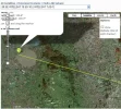
I've grabbed another snap from dishpointer showing the line of sight zoomed out to cross the uk ..
In actual fact If I zoom out one more step I cross the Wash ..in East anglia..
The line shows how I have to directly bisect Manchester ...and also cross the Pennines ...
Possibly at a very high point ..
Is it possible that could be the reason ..?
It _could_ be ...I just don't know...
Here's the pic
rgds
VS
 

Attachments

  • accross the uk.webp
    accross the uk.webp
    103.6 KB · Views: 33
yes the pennines are pretty high there --
also the centre of manchester is raised somewhat -i,m thinking, on the north side -- shudehill, - cheetham hill -- where your line crosses
a visual measure from your dish position , across the city when the air is clear - like after a rainstorm -- will give a good idea if your view is blocked or not -
for shorter visual incline checks i use the tool picture below -- its an old joinery tool -- with the base turned upwards -- but if placed or held perfectly level - from a position level with the bottom of the dish it is surprisingly accurate -- you just set the incline angle and look along the top edge like a gunsight and see if it clears the obstacle
a bigger much more acurate version can be made using 2 "very straight" batons screwed together at one end set at at the angle you want - and a longer more accurate spirit level - placed on or fastened to the bottom baton -- it looks a bit crude but its more accurate than you might think -- the method has served me well when siting my dishes

cheers n_b
 

Attachments

  • 1 tool.webp
    1 tool.webp
    65.2 KB · Views: 29
  • 2tool.webp
    2tool.webp
    82.5 KB · Views: 27
  • 3 tool.webp
    3 tool.webp
    68 KB · Views: 21
  • 4 tool.webp
    4 tool.webp
    62.9 KB · Views: 28
Thanks Nelson ...the info is much appreciated m8 ....and at the risk of all the crude comments and jokes that I know will follow ..
I'm gonna risk it and say...
I rather like your tool...
:D
..
(sits with coat and gets ready to leave.....)
VS
 
Vipersan said:
Thanks Nelson ...the info is much appreciated m8 ....and at the risk of all the crude comments and jokes that I know will follow ..
I'm gonna risk it and say...
I rather like your tool...
:D
..
(sits with coat and gets ready to leave.....)
VS

There are folk here trying hard to restrain themselves ....................... :-O-st
 
I've recently bought one of those laser pointer pens, to get an idea which trees are blocking my arc for 30°W. VS, if you can get hold of one, would it help if you taped it to the underside of the LNB arm? I'm not suggesting you'll be able to see which hill is in the way but it may rule out something nearer.


nelson_b said:
...yes the pennines are pretty high there......

I thought Katie Price lived in Essex??

(See, ignore the obvious and go for the secondary target....I restrained myself for as long as I could)
 
Tivù said:
There are folk here trying hard to restrain themselves ....................... :-O-st

You have no idea ! :D
 
sonnetpete said:
I've recently bought one of those laser pointer pens, to get an idea which trees are blocking my arc for 30°W. VS, if you can get hold of one, would it help if you taped it to the underside of the LNB arm? I'm not suggesting you'll be able to see which hill is in the way but it may rule out something nearer.


I thought Katie Price lived in Essex??

(See, ignore the obvious and go for the secondary target....I restrained myself for as long as I could)

Nice Swerve Pete...

Yep thought about using a laser pen ...I have 2 ..
but at such low elevation ...its theoretically possible I could end up blasting it through someones bedroom window ..
..so would have to be very careful.
rgds
VS
 
Rick said:
You have no idea ! :D

Loving the restraint m8 ..
btw ..you are not that far from me ...
Have you ever attempted ...or indeed succeeded in bagging this bird. ?
rgds
VS
 
furthest I can hit is 62e. I was shocked to get that tbh. Pm me a tp and next time I do a motorized that has los I will give it a go .
 
Vipersan said:
.....its theoretically possible I could end up blasting it through someones bedroom window ..
..so would have to be very careful.

Well, if you do illuminate someones boudoir, I'd hazard a guess your line of sight is definitely too low! (and may invite a visit from plod)
 
sonnetpete said:
Well, if you do illuminate someones boudoir, I'd hazard a guess your line of sight is definitely too low! (and may invite a visit from plod)
Therein lies the problem Pete ..
..I'm aiming fora gap beteen house rooftops ...
so It could happen if the motor should move with a laser pointer attached and functional..


@Rick ...I'm told Manasat is the strongest transponder on Intelsat 7/10 at 68.5°E

12575 V
tp 20 ManáSat
DVB-S 3378-3/4

If you manage to bag it Rick ...I'd appreciate knowing its even possible..
cheers m8
VS
 
Vipersan said:
Is it possible that could be the reason ..?
My bet is on the tree... picture 2/4. Where is the dish pointing in that picture?
 
Back
Top