The Aero Thread..

Took some notes on the Drrrriffft issue ..
let the whole system cool ..then powered up and activated the lnb ...ran up HDSDR and Jaero ...at 23:45 ..
located the T data stream at 1,537,106,635...then waited .....and watched jaero do it's stuff interpreting flight data ...which is now coming through fairly solidly...
Until the R/T data packets turned bad ..
Now minight ....and that same stream is now located at 1,533,774,079
So yes the drift is substatial ...BUT ...is this the LNB ? ....or is it SDRplay that is drifting ....?
I will try and get to the bottom of this if I can..
It is well documented that RTL SDR dongles drift at high frequencies ...but a purpose built unit like SDRplay ?
Surely not ....
Does Airspy drift at all ?
Just curious..
rgds
VS
Testing RTL-SDR and SDRPlay receivers for AERO reception - rtl-sdr.com
 
You could introduce an offset frequency adjustment to compensate when the dvice has warmed up, and keep the PC running all the time, but the misers on the forum would object.

Can you take some temperature readings when stable and once the board starts drifting. It might be a peltier device or three will keep the board within the range for continued stable operation.

Have you got room at the top of your fridge ?
 
Installed the new Titanium C1PLL ...and tested it with SDR# ..
What have a learned so far ..
Signals are more pronounced and the background noise is much reduced ..
The signals really 'pop' out now ...so perhaps the old C1PLL was not working as well as it could.

I can now use this PLL combo with SDR# ...which means I can perhaps try for 2 x channels ?

But to the main question ...the very evisent drift ..
Well ..there were 2 possibilites ..SDRplay thermal drift ..or LNB drift..
Removed the SDR play and lifted it clear of the Optiplex ..so not affected by internal heat sources ..and powered up the PC and ran up SDR# ..
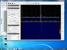
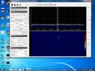
Switched on the C-band lnb ...and took my first screen grab at 19:05 ...
It was immediately apparent I was in the right spectral region ...
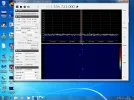
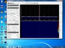
I then took further screen images at 19:15 ...then 19:30 and lastly 20:00
a tiny drift was evident but not enough to be an issue ..
This was NOT the case with the ESX non Pll ..which powered up miles off target ..and drifted quite substantially over time...
See for yourself with the 4 images ...
So imo PLL is important..
BUT ..this is not the end of the story ...
without powering anything down I re-buried the SDRplay under the DVD drive and directly on to of the Optiplex hard drive ...thus will inevitably get warm ..
That was at 20:15 ...and it is now 20:40 ..
Unsurprisingly the chosen frequency has drifted ..but Surprisingly is still within the correct region of the spectrum ...
The amount drifted is roughly so far is about the width of one of aero data burst streams ..
So ..my thoughts on this ..errr...problem .
Well I can't keep the SDRplay unit cool ...but what I can do is rely on the sandwiched position and the heat from the hard drive to stabilise the SDRplay once the PC has been on for about 10 minutes.
..thus hopefully preventing SDRplay vxo drift of huge proportion once the pcs internal temerature reaches optimum.
What I can say is that imo the largest problem of the 2 was indeed the LNB ..and that PLL IS important to this particular experiment.
rgds
VS1905 Startup.webp 1915.webp 1930.webp 2000.webp
 
..another thing worth noting is that there _appears _ to be sufficient signal now maintained certainly for a few hours now to make jaero viable even during the shift above and below equatorial plane using Carl ....
thus Elevational tracking is perhaps not needed for such minimal inclination on a less directional dish ..
I appear to capture most traffic now without too many bad R/T packets...without moving the dish..
rgds
VS
 
Last edited:
So I guess the next thing to attempt is Plane Plotter ...which I assume is a software that has to be purchased ?
A few questions tho'
Is PP a one off payment or liscenced for time periods ?
How expensive is it ..?
I have already spent a small fortune so if expensive ..it may have to wait ..
How CPU intensive is it ?
I dont want to overburden the Optiplex which is currently using about 85% ..
...that said ...maybe I can export the data to a second pc via wifi on my lan ..for display purposes ?
advice here is welcome.
rgds
VS
 
I might actually consider this as 27mhz TCXOs can be got for as little as a couple of quid ..
interesting ...
Not sure my eyesight is up to the task tho'
but I do like the fact that there is a link to a schematic pdf for SDRplay ..which I grabbed a copy of.
Bloodly cheapskates just using a crystal when TCXOs are so cheap ...
 
So ..I've downloaded an installed Plane Plotter ...but not before I set a restore point ...just in case there aren't enough resources ...
I guess I'm on day one of the 21 day trial period ..
This software looks mighty complicated ...so the clock is ticking on my 21 days ..
would someone kindly walk me through the process of getting PP to recognise and work with the data from Jaero (which is now consistent and useable) ...I now have around 500 + planes in my log file ..but how to get the real time data to plane plotter ?
There are no idiot guides that I can find on the www ...but that's what I need now ...a dummies guide to making this work ..
So far I have SDRplay >SDR#> Jaero > (Cband data) ????? PPlotter
As I've said this may be too much for the Optiplex ...but I'd like to find out before I run out of days ...and before I commit to purchase.
cheers
VS
 
Last edited:
According to the blurb, if you are a 'Master User' by virtue of returning raw data on a regular basis, you don't need to pay anything

This looks interesting as well

Internet sharing
PlanePlotter can send its message data to a shared server so that messages that you have received locally (ACARS, HFDL or ADS-B), can be seen by other PlanePlotter users in different areas. In this way, each user enjoys the reception coverage of all the cooperating users together. Consult the software licence for the special terms and conditions applicable to this feature.
 
According to the blurb, if you are a 'Master User' by virtue of returning raw data on a regular basis, you don't need to pay anything

This looks interesting as well

Internet sharing
PlanePlotter can send its message data to a shared server so that messages that you have received locally (ACARS, HFDL or ADS-:cool:, can be seen by other PlanePlotter users in different areas. In this way, each user enjoys the reception coverage of all the cooperating users together. Consult the software licence for the special terms and conditions applicable to this feature.

Don't forget Skomedals thread of two weeks ago

Flightradar 24 new improved site
 
So I guess the next thing to attempt is Plane Plotter ...which I assume is a software that has to be purchased ?
A few questions tho'
Is PP a one off payment or liscenced for time periods ?
How expensive is it ..?
I have already spent a small fortune so if expensive ..it may have to wait ..
How CPU intensive is it ?
I dont want to overburden the Optiplex which is currently using about 85% ..
...that said ...maybe I can export the data to a second pc via wifi on my lan ..for display purposes ?
advice here is welcome.
rgds
VS
VS, drop Spacedish a PM he does planeplotter support and will be able to answer your questions.
 
Jaero, set output UDP on port 8765
PP, into IO settings, click on ACARS from Jaero
File, chart open, globe.
Start decoding

Once the chart knows where it is hold down shift button and click on map to download a Google satellite image.
 
Sort of working ..
Not getting a lot of data atm ...
maybe the decination of Inmarsat ...but hey ...it's a start ..
cheers to Paul and to SpaceDish..
;)PP.webp
 
Jaero, set output UDP on port 8765
PP, into IO settings, click on ACARS from Jaero
File, chart open, globe.
Start decoding

Once the chart knows where it is hold down shift button and click on map to download a Google satellite image.
Thanks Paul ...
Sort of have it all working ..though the extra demand on the Optiplex sometimes causes Jaero to stop ??
..shutting it down and restarting usually fixes it..

It is a bit disconcerting however that one might follow a flight over the Atlantic ...only to see the planes icon suddenly vanish as though it landed in the sea ..
I assume either a chunk of bad data is received thus foiling the course plot ...or that a lack of info received causes a time out and the planes position is not updated and is removed from the map ..
??
 
There is something _else_you may be able to help me with Paul ?
Setting my home location in options ...
I used 53.508334, 002.351143 ....then hit test ...and it puts me near a farm somewhere in the uk ..but not where I should be ..
the cross on the map is somewhere off the coast of cornwall ..in the sea ..
So basically google maps does not appear to know wtf to display ????
Selecting 'Radar' view ..at least puts the cross in the right area of the UK ....but googgle maps can't get it right at all ..
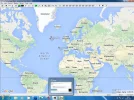
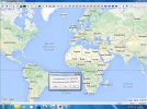
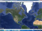
Here are a couple of pics to show what I mean..
map.webp radar.webp
 
satellite.webp
...not sure what I did ..but selected the 'satellite' image ...and zoomed out ...and the home location appears to have corrected itself ...
returning to the google maps overlay ..and the correction held ..??
It's like the map data needs refreshing to establish correct location relative to 'it'..
most confusing.
 
It is a bit disconcerting however that one might follow a flight over the Atlantic ...only to see the planes icon suddenly vanish as though it landed in the sea ..
I assume either a chunk of bad data is received thus foiling the course plot ...or that a lack of info received causes a time out and the planes position is not updated and is removed from the map ..
??
When the flights disappear over the North Atlantic its due to lack of VHF coverage from the ground stations (there isn't any in the middle of the Atlantic), I would have thought the satellite downlink would have covered this area tho, have you tried tracking any of the flights that appear in Jaero?
 
When the flights disappear over the North Atlantic its due to lack of VHF coverage from the ground stations (there isn't any in the middle of the Atlantic), I would have thought the satellite downlink would have covered this area tho, have you tried tracking any of the flights that appear in Jaero?
I'm only using live info from Jaero Smoggy ...not relying on the data pool ..just my own from Cband ?
Certainly I've seen planes in air space off the coast of the US ...displayed on PP
 
Ah... I presumed you where pulling in from the internet too, it's possible that the plane you where tracking has been handed off to another beam or another satellite all together, that would cause it to drop off the map
 
Back
Top