
You are using an out of date browser. It may not display this or other websites correctly.
You should upgrade or use an alternative browser.
You should upgrade or use an alternative browser.
How does DX Bozoth do it?
- Thread starter Captain Jack
- Start date


Archived-1
Persona non grata
- My Location
- uk
It makes our setup's look like mecanno, great setup thanks for posting bonou

Vipersan
Emmett Browns Ghost
- My Satellite Setup
- IP9000HD +
TD110 Dish and TD88 Dish in Tandem
66°East to 60°West.
AZbox PrmHD + OpnbxS9HD + Skybox + DrHD F15
2x VboxII AZ-EL
2 m+ Alcoa PF + BSC421 C-Band lnbf...
+SS2/TwHnS2-3200 pci/TBS6925 pci
1.5 Fortec Star -Gbox - HtoH Ku/Ka/C
- My Location
- UK
There's a project for you Bonou...you could ask his permission to add subtitles to the vid ..for the benefit of us momoglots

- My Satellite Setup
- TM 5402HD
Sky+ UK.
- My Location
- Scottish Borders
Fabulous pics - thank you for posting them, thats one seriously impressive install.
The ladder lashed to the plank looks a bit scary though!!
The ladder lashed to the plank looks a bit scary though!!
bonou2
Member
- My Satellite Setup
- strong 4500, openbox X801, vantage 7100ts, vantage X201 CI, goldenmedia 9080,goldenmedia uni-box2,tbs6925+,inverto black ultra+C120,panorama er-861, zinwell lnb 15K C- band,intersat 20K
- My Location
- Romania
hi to all
And now a few words about this project:4,6m PFA installation-by @DX Bozoth
the project was started in September 2013 and he hope to finish it this year 2014
the dish mount can work between 140E-71W (made some changes in the mechanical mount)
he wants the dish to be operational between 100E-58W
also he want to receive this satellite ---express-A2@103E
the dish is not working yet fully 100%
now is running various tests, adjustments, calibrations
best regards from DX Bozoth
And now a few words about this project:4,6m PFA installation-by @DX Bozoth
the project was started in September 2013 and he hope to finish it this year 2014
the dish mount can work between 140E-71W (made some changes in the mechanical mount)
he wants the dish to be operational between 100E-58W
also he want to receive this satellite ---express-A2@103E
the dish is not working yet fully 100%
now is running various tests, adjustments, calibrations
best regards from DX Bozoth

Lexzie
Member
- My Satellite Setup
- Xtrend ET10000 DVB-C, DVB-S2, and IPTV
Dreambox DM920 DVB-C/DVB-S2X/DVB-T2
TBS 5925 USB-tuner
80 cm fixed dish (28.2E/23.5E/19.2E/13E)
180cm Channel Master offset dish with polarmount (39E-34.5W, Ku-band)
- My Location
- The Netherlands
hi to all
And now a few words about this project:4,6m PFA installation-by @DX Bozoth
the project was started in September 2013 and he hope to finish it this year 2014
the dish mount can work between 140E-71W (made some changes in the mechanical mount)
he wants the dish to be operational between 100E-58W
also he want to receive this satellite ---express-A2@103E
the dish is not working yet fully 100%
now is running various tests, adjustments, calibrations
best regards from DX Bozoth
And how will he receive 103°E when it's below the horizon in Hungary?
Even in the most eastern part of Hungary the elevation is still -2.1°.
I wonder if setting up the dish a few meters higher will solve that.
Since it is in inclined orbit, is the bird receivable when it reaches it's highest apogeum, when the bird is app. 120 km further from the earth than non-inclined satellites, so it peaks just above the horizon?(ref.: http://www.n2yo.com/satellite/?s=26098)
That would really be a fringy fringe reception indeed!
I want a retirement just like him!
Lexzie
Member
- My Satellite Setup
- Xtrend ET10000 DVB-C, DVB-S2, and IPTV
Dreambox DM920 DVB-C/DVB-S2X/DVB-T2
TBS 5925 USB-tuner
80 cm fixed dish (28.2E/23.5E/19.2E/13E)
180cm Channel Master offset dish with polarmount (39E-34.5W, Ku-band)
- My Location
- The Netherlands
Like I said:He is at 47°19' N 21°07' E
Express A2 has 7.0° inclination, is over the horizon there for several hours, topping at 2.3° elevation.
No big deal!
How do you calculate or where can you find the maximum elevation of 2.3°?Since it is in inclined orbit, is the bird receivable when it reaches it's highest apogeum, when the bird is app. 120 km further from the earth than non-inclined satellites, so it peaks just above the horizon?

hvdh
Specialist Contributor
- My Satellite Setup
- Dr.HD F16, TBS 5927, T-55, Laminas 120 cm
- My Location
- Oss, NL (5.5°E 51.8°N)
By using Gorbtrack. (There are many other more graphic softwares, but Gorbtrack suits my needs perfectly)
Enter the location coordinates, the latest TLE database, then adjust the time manually to find the highest elevation.
Enter the location coordinates, the latest TLE database, then adjust the time manually to find the highest elevation.
Lexzie
Member
- My Satellite Setup
- Xtrend ET10000 DVB-C, DVB-S2, and IPTV
Dreambox DM920 DVB-C/DVB-S2X/DVB-T2
TBS 5925 USB-tuner
80 cm fixed dish (28.2E/23.5E/19.2E/13E)
180cm Channel Master offset dish with polarmount (39E-34.5W, Ku-band)
- My Location
- The Netherlands
Indeed that's a great program, where do I find the latest TLE database?By using Gorbtrack. (There are many other more graphic softwares, but Gorbtrack suits my needs perfectly)
Enter the location coordinates, the latest TLE database, then adjust the time manually to find the highest elevation.
Also is there an update for the sats.csv?

Captain Jack
Retired human
- My Satellite Setup
- See signature
- My Location
- North Somerset
He should allow people to visit his place. I wouldn't mind paying even!
Captain Jack
Retired human
- My Satellite Setup
- See signature
- My Location
- North Somerset
I have a question - why does he have so many large dishes? Surely he would have say one for Ku, one for C circular and maybe another for linear?
I wonder how much all these dishes cost him
I wonder how much all these dishes cost him
hvdh
Specialist Contributor
- My Satellite Setup
- Dr.HD F16, TBS 5927, T-55, Laminas 120 cm
- My Location
- Oss, NL (5.5°E 51.8°N)
Best choice for TLE's to start with: http://www.celestrak.com/NORAD/elements/geo.txtIndeed that's a great program, where do I find the latest TLE database?
Also is there an update for the sats.csv?
Sats.csv is not essential for Gorbtrack to function, it is only for extra information to be shown on the Sat Info tab.
The old sats.csv that comes with the program will create chaos in the list, you're better off removing it from the GorbTrack folder.
bonou2
Member
- My Satellite Setup
- strong 4500, openbox X801, vantage 7100ts, vantage X201 CI, goldenmedia 9080,goldenmedia uni-box2,tbs6925+,inverto black ultra+C120,panorama er-861, zinwell lnb 15K C- band,intersat 20K
- My Location
- Romania
message from: DX BozothHe should allow people to visit his place. I wouldn't mind paying even!
everyone is are welcome to visit his place (farm)
best regards from DX Bozoth
Attachments


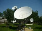

Captain Jack
Retired human
- My Satellite Setup
- See signature
- My Location
- North Somerset
Are these tyre rims the dishes are sat on? Surely, he didn't steal AS's idea?!
Lovely pictures as always...
Lovely pictures as always...

- My Satellite Setup
- A little less analogue, and a lot more crap.
- My Location
- UK
Planning officers and Esthetically Pleasing..
4 words not often found in the same sentence...
Bozoth probably has a nice room under the house for anybody that comes knocking.
Lexzie
Member
- My Satellite Setup
- Xtrend ET10000 DVB-C, DVB-S2, and IPTV
Dreambox DM920 DVB-C/DVB-S2X/DVB-T2
TBS 5925 USB-tuner
80 cm fixed dish (28.2E/23.5E/19.2E/13E)
180cm Channel Master offset dish with polarmount (39E-34.5W, Ku-band)
- My Location
- The Netherlands
Still no explanation on how he could receive the frequency on ME-beam while on the same frequency the much stronger Europe beam is active.
I could think of an explanation when they would have been on separate satellites. But there were (and still are) both on Amos 3 afaik.
I could think of an explanation when they would have been on separate satellites. But there were (and still are) both on Amos 3 afaik.
Captain Jack
Retired human
- My Satellite Setup
- See signature
- My Location
- North Somerset
Different satellites doesn't explain it - they would still be beaming from the same position, so would clash.
Lexzie
Member
- My Satellite Setup
- Xtrend ET10000 DVB-C, DVB-S2, and IPTV
Dreambox DM920 DVB-C/DVB-S2X/DVB-T2
TBS 5925 USB-tuner
80 cm fixed dish (28.2E/23.5E/19.2E/13E)
180cm Channel Master offset dish with polarmount (39E-34.5W, Ku-band)
- My Location
- The Netherlands
Different satellites cannot be exactly on the same position and with a dish large enough you could distinguish them.
Besides that the Amos 2 was in it's last days a little bit in inclined orbit, so potential more distance possible between the Amos 2 and 3 on certain times.
At the moment Lyngsat reports both signals on Amos 3.
But when I look in the wayback machine they used to be on Amos 3 resp. Amos2.
But his last report for 10758 V was on 12 nov. 2017. By then the Amos 2 was long ago retired.
Talking about inclined orbit: Anyone know if he succeeded in receiving Express-A2@103°E?
Besides that the Amos 2 was in it's last days a little bit in inclined orbit, so potential more distance possible between the Amos 2 and 3 on certain times.
At the moment Lyngsat reports both signals on Amos 3.
But when I look in the wayback machine they used to be on Amos 3 resp. Amos2.
But his last report for 10758 V was on 12 nov. 2017. By then the Amos 2 was long ago retired.
Talking about inclined orbit: Anyone know if he succeeded in receiving Express-A2@103°E?