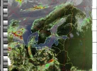
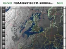
My go at WXSAT

What you guys need is a combination of a Hi-pass/Low-pass filter, but they would have to be very sharp.

We used what was called a digital brick wall hi/low filter, the combination of the two filters would be very tight, the low-pass would let everything up to 138.5 MHz through, and the hi-pass would start at 136.5 MHz and everything above that, the overlap after the combination would be about 2 MHz wide.

The big draw back was the $1200 price.
 
What you guys need is a combination of a Hi-pass/Low-pass filter, but they would have to be very sharp.

We used what was called a digital brick wall hi/low filter, the combination of the two filters would be very tight, the low-pass would let everything up to 138.5 MHz through, and the hi-pass would start at 136.5 MHz and everything above that, the overlap after the combination would be about 2 MHz wide.

The big draw back was the $1200 price.

At that price I will put up with the black bars :eek:
 
Ive had an idea to extend the window of opportunity of the NOAA's. Lets see if it works - the theory is good but............
 
This is this mornings scan NOAA 18 Northbound 41W MEL 13W 137.9125.
Poor signal at the bottom.What seems to happen is that the satellite signal has all but gone when the recording is about 90%I think that some of the problem is that the houses block the signal at the Northbound start/ Southbound End of the pass.I have shoved the Antenna up about four foot That may Help a bit.The houses are near on south facing.
noaa-18-04280931-hvct-precip.webp
 

Attachments

  • p1030261.webp
    p1030261.webp
    73 KB · Views: 12
  • p1030262.webp
    p1030262.webp
    113.1 KB · Views: 13
  • p1030263.webp
    p1030263.webp
    50 KB · Views: 15
The raised antenna looks to looks to be an improvement not as much signal fade at the end of the recording.I need to see the same improvement in the next recordings if so I will fasten it there permanently.It would be nice if I could get it up on the corner over the gutter I recon that it would do well there.Unfortunately it is not likely to happen I am not safe up ladders now.One can dream though can't one.:)
 

Attachments

  • noaa-19-04281501-msa-precip.webp
    noaa-19-04281501-msa-precip.webp
    125.8 KB · Views: 9
Looks like you got it.
 
Here is the latest pass from NOAA 18, West Coat US on 4/28/18 at 0930 PDT

Looks like Northern California might get some rain.

West Coast US on 4-27-18.webp
 
Still not bad all northbound though I have to wait until tomorrow for the southbound ones.The precip ones on this pass are not good though
This is NOAA 15 66E MEL 3 E long 17:27 UTC.
noaa-15-04281727-class.webp
 

Attachments

  • noaa-15-04281727-hvc-precip.webp
    noaa-15-04281727-hvc-precip.webp
    116 KB · Views: 8
Last edited:
NOAA 15 again.24 W MEL 21 W Long.precip images fine this time round.
Finished now until tomorrow .
noaa-15-04281908-hvct-precip.webp
 
Some interference on this one.Not getting the recording problem now though.
NOAA 18 30E MEL 16 E LONG 07:27:17 UTC.
The next one is NOAA 15 32 W MEL 16 W LONG 08:30:29 UTC.I will see what that one looks like..It looks like brollys needed down south.:)
noaa-18-04300727-msa-precip.webp
 
Last edited:
I said in the other thread not long back that I only get clean scans on low East scans .
wrong I do sometimes get good ones on higher East scans.
this is NOOA 18 Northbound 25E Mel 18E Long 17:31 UTC.
Though I only got one enhanced scan.
noaa-18-05251731-mcir-precip.webp
 

Attachments

  • noaa-18-05251731-norm.webp
    noaa-18-05251731-norm.webp
    30.6 KB · Views: 7
I said in the other thread not long back that I only get clean scans on low East scans .
wrong I do sometimes get good ones on higher East scans.
this is NOOA 18 Northbound 25E Mel 18E Long 17:31 UTC.
Though I only got one enhanced scan.
View attachment 117678


Nice picture :Y

Is that a layered picture? If so I will have to find the command line to add it in to my pi setup.
 
I have not been getting very good scans from NOAA 18 lately.I have only been getting the west scans.( I forget to change the frequency.:))I could do with an automatic frequency changer but where would the fun be then.:).There is a 18 East pass at 17:34 UTC must try to get that one
This scan from NOAA 18 is from a West pass quite a good one too..It must have gone between the houses.
NOAA 18 Southbound. 51 E MEL 10 W LONG.09:20 UTC.
noaa-18-06110920-hvct-precip.webp
 

Attachments

  • noaa-18-06110920-norm.webp
    noaa-18-06110920-norm.webp
    44.6 KB · Views: 6
Got the 17:34 UTC scan only just though.
NOAA 15 was scanning at 17:25 UTC.
NOAA 18 was due at 17:34 UTC time enough to change the frequency I thought .Wrong the N15 enhancements were still going on at 17:34.
WXtoimg started scanning NOOA 18 on the wrong frequency I stopped it pronto change the frequency to the correct one restarted recording,got a good scan of NOAA 18.
Who's a clever boy then.Well me this time it dose not happen very often these days.:D
NOAA 18 Northbound 25 E MEL 18 E LONG 17:34 UTC.
noaa-18-06111735-mcir-precip.webp
 

Attachments

  • noaa-18-06111735-norm.webp
    noaa-18-06111735-norm.webp
    28.7 KB · Views: 6
I missed that one Chris I was down the garden.It was at 4 W here 20;12.
The West passes are the ones where the houses get in the way.Some worse than others.
 
I missed that one Chris I was down the garden.It was at 4 W here 20;12.
The West passes are the ones where the houses get in the way.Some worse than others.

In your pictures you hardly have any interference :Y

Are you using any pre-amp/filters?
 
No I just use the home made antenna.With the software running on windows 7.I do get pagers sometimes.
The rear of the house is North facing.On the West passes I get low signal interferance at the start of northbound scans and at the end of southbound scans
Edit below are two scans from NOAA 18 one East and one West
 

Attachments

  • noaa-18-05171902-mcir-precip.webp
    noaa-18-05171902-mcir-precip.webp
    167.5 KB · Views: 5
  • noaa-18-05180718-hvct.webp
    noaa-18-05180718-hvct.webp
    93.7 KB · Views: 6
Last edited:
Back
Top